


In Which I Try to Solve an Art Mystery
(spoiler alert: I failed.)

Sometimes this newsletter teaches me things
Last week I wrote about what was, honestly, just one of those thoughts that rattles around in my head and seems unimportant: Is it OK that there are things I kind of wish I could do or be, but never actually will? All those hobbies I will never take up, interests I will never pursue, but I still harbor a secret little crush on?
Nobody will be interested in this, I thought, but I’ll just put it out there anyway because it’s on my mind and it would be fun to illustrate.
Well, I cannot believe the response from you people! Clearly this hit a nerve. Go read the comments if you haven’t already. You are all so interesting and well-rounded already, but apparently you, too, carry around low-stakes unrealized ambitions, just like I do. I loved hearing about it. Thank you.
This week, this newsletter taught me that I can actually do a full-on sketchbook version of the newsletter before I type it up and send it to you. Until now, I’d been drawing the pictures on any piece of paper I had handy, and making notes in another notebook, and compiling it all here.
This week, I filled six pages of a crisp new Stillman & Birn Zeta 8x10 sketchbook, and it was great fun. My sketchbooks have always been weirdly light on text, considering that I’m a writer, but this was a lovely form of sketchbook storytelling that I’ll definitely be doing again. So thanks for showing up here, I wouldn’t have tried this if not for you.
It started with a walk to Council Crest Park
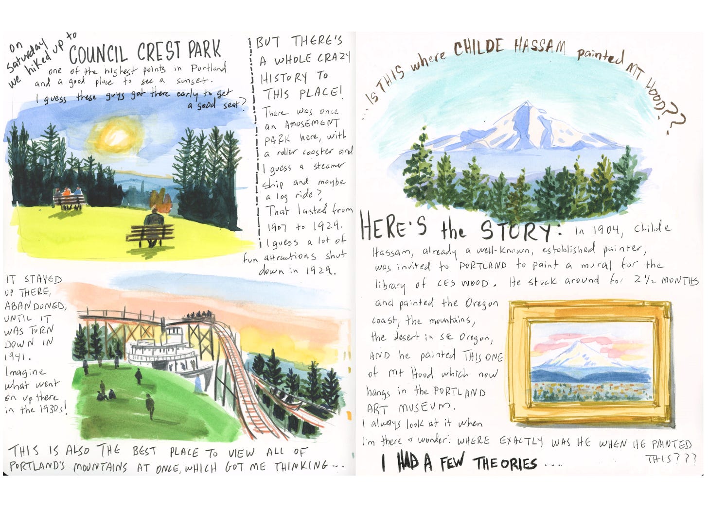
We took a walk along Portland’s 4T trail, a very interesting and unusual trail that goes from the zoo, along a freeway overpass (it’s not as weird as it sounds), up to Council Crest Park, one of the highest points in Portland, then down through more woods to Oregon Health & Science University (OHSU), where you can pick up the Aerial Tram, then take the streetcar and light rail back to the zoo where you started.
Council Crest Park is fascinating to me because it was once the site of an old-fashioned amusement park. It closed in 1929, presumably a casualty of the Great Depression, but wasn’t torn down until 1941, which only makes me wish desperately that I could’ve been in Portland in the 30s to sneak up to the creepy abandoned amusement park and write ghost stories or just think my creepy thoughts.
Today you go up there mostly for the views of the mountains surrounding Portland, including, of course, Mt. Hood.
That got me thinking about Childe Hassam’s painting…
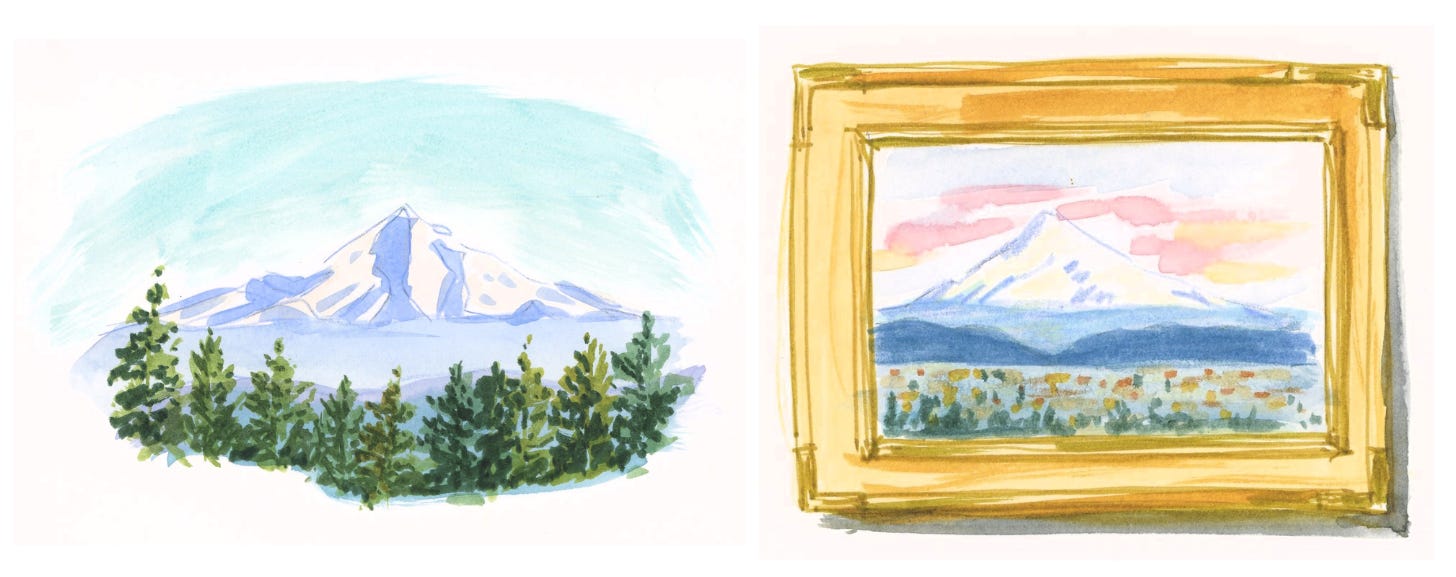
Childe Hassam, whose paintings of flags hanging from buildings in New York during World War I are probably familiar to you, traveled to Oregon twice in the 1910s to paint. He did this painting of Mt Hood in 1908. Every time I see it at the Portland Art Museum, I wonder where, exactly, he stood while he was painting it.
I already had a couple of ideas, but I decided on this walk that I was going to figure it out.
So I did a little detective work…
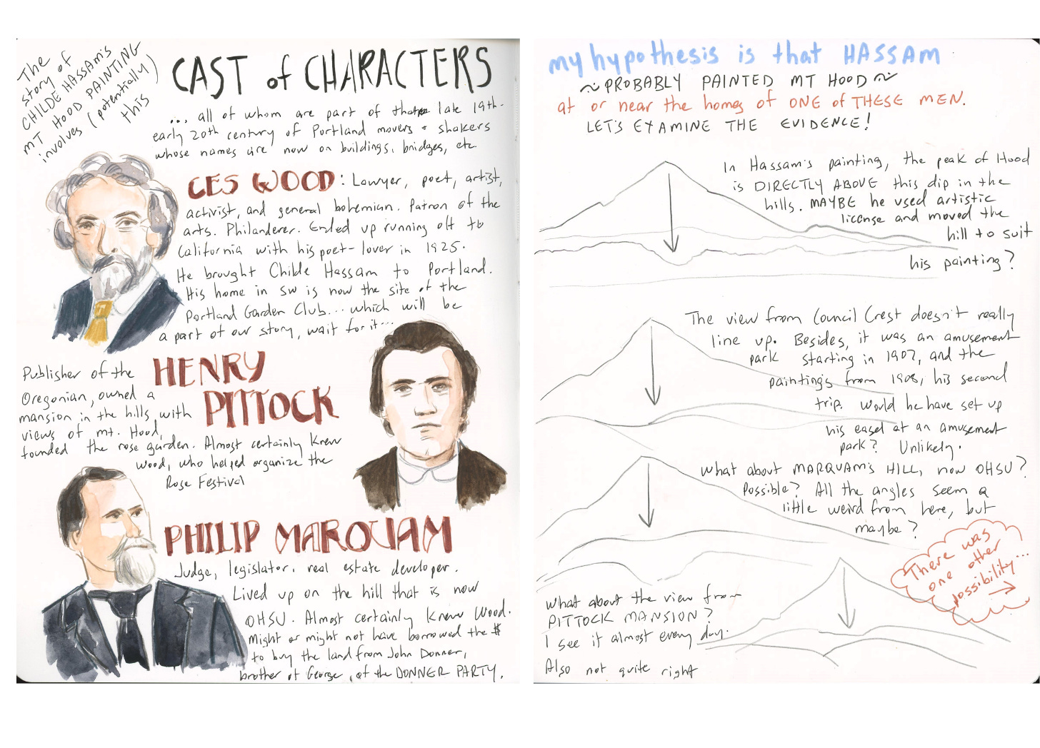
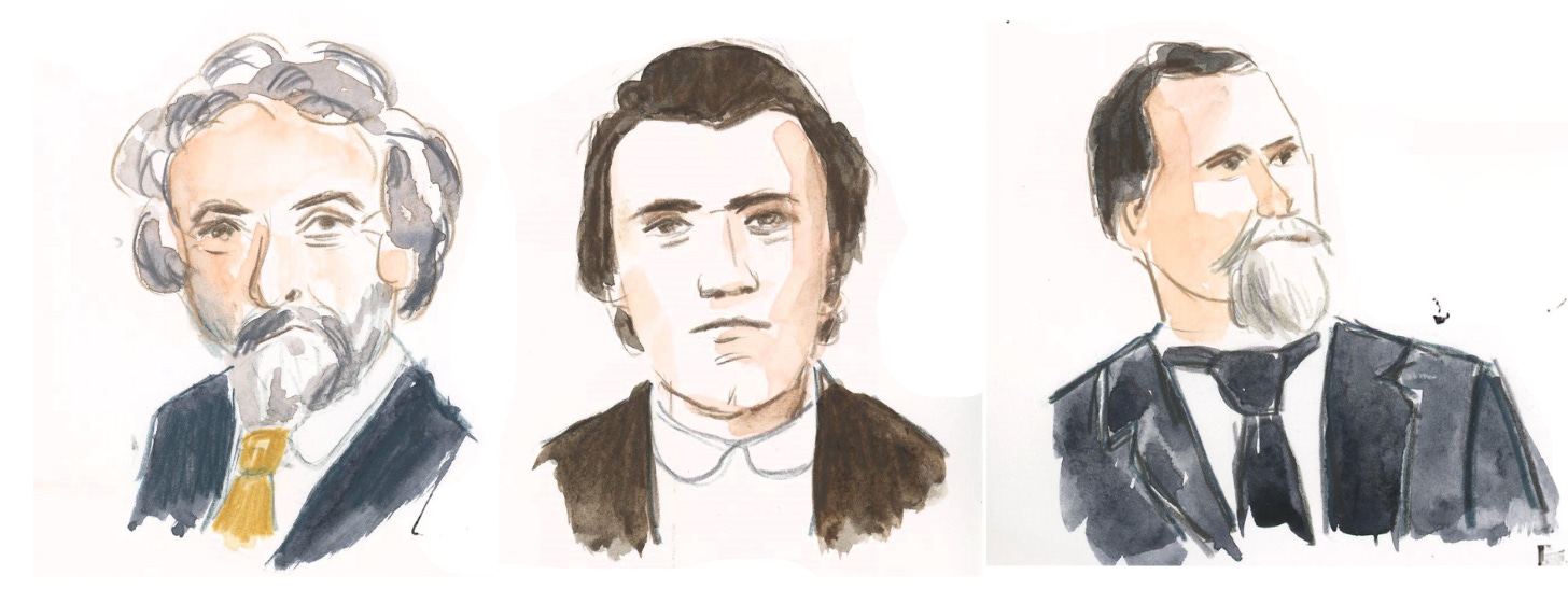
I learned that Hassam was invited to Portland by C.E.S. Wood, one of Portland’s original bohemians. He was a lawyer, poet, artist, and activist. He defended Emma Goldman and Margaret Sanger when they came to speak in Portland, and was friends with his neighbor John Reed. (Remember the movie Reds, with Warren Beatty? That’s John Reed.) He was also a philanderer who eventually ran off to California with a poet and lived out his golden years with such compatriots as Ansel Adams and John Steinbeck.
So Wood invited Hassam to come to Oregon, paint a mural for his library, and perhaps pick up some other commissions from Wood’s many wealthy friends. Hassam made two trips in the 1910s, and painted Portland, as well as the Oregon coast and the desert. (Did you know Oregon had a desert? We’ll get to that.)
So where did Hassam set up to paint Hood? I had a few ideas.
He could’ve gone up to Pittock Mansion, which is a view of Hood I know well, because I walk up there almost every day. Henry Pittock was a newspaper publisher who would have known Wood, because Pittock founded the International Rose Test Garden in Portland (oh there’s a story for another newsletter) and Wood organized Portland’s first Rose Festival.
Or he could’ve gone up to Council Crest, but it was a brand new amusement park at the time, or maybe an amusement park under construction. It had the advantage of a streetcar that would carry him up the hill, but would he have wanted to paint at an amusement park?
Then there’s the site that is now OHSU. At the time, the property belonged to Philip Marquam, a judge, legislator, and real estate developer. (If you can believe what you read on the internet, he borrowed the money to buy that place from John Donner, brother of George Donner of the Donner Party. This, too, warrants further investigation.)
All three offer lovely views of Hood, with Portland in the foreground. Which one is the best candidate? I tried to figure it out by looking at the configuration of low-lying hills in the foreground and lining those up with the peak of Hood. You can see my attempts at this analysis in the sketchbook spread above.
Then again, Hassam could’ve painted those hills any way he liked. He could’ve used—damn him!—ARTISTIC LICENSE!
I had one more possibility to investigate.
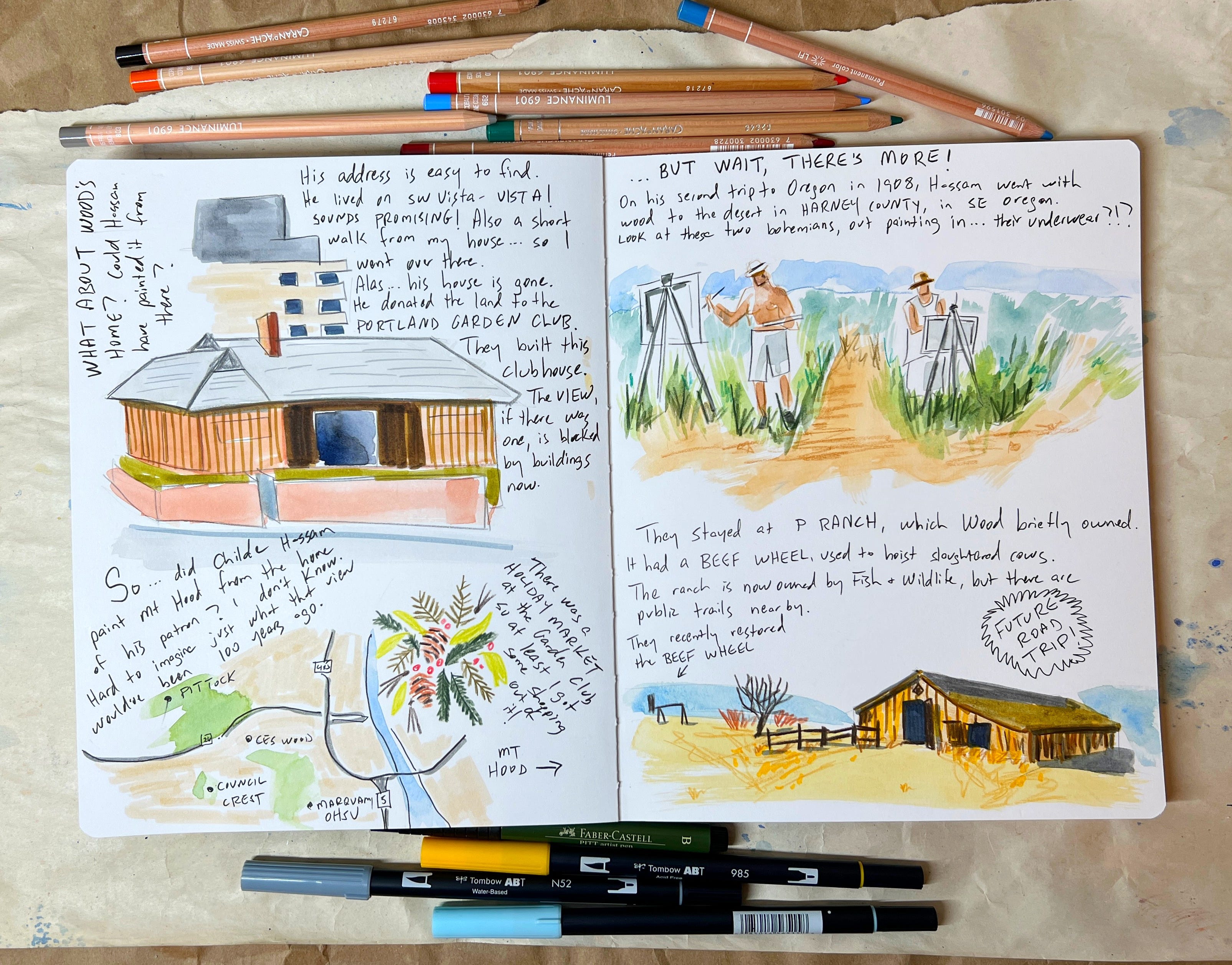
Maybe he painted it at CES Wood’s house
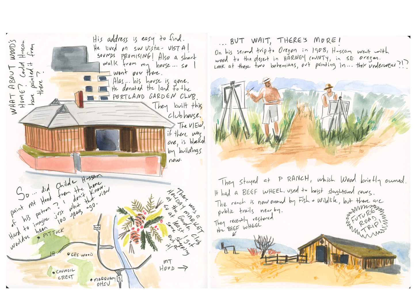
Why not paint at the home of your patron? I read that CES Wood lived on SW Vista (Vista! That’s a promising name), and I knew that some of the homes on that street had good views across town to Hood.
So I went over to the address. CES Wood’s house is no longer there. The property was donated to the Portland Garden Club (these civic-minded ruling class town founders and their generous bequests of land!), who built a clubhouse on the site.
There are taller buildings behind the clubhouse, making it impossible to gauge what kind of view Wood had back then. But the trip was not a total waste: the garden club was having a holiday crafts sale, so at least I got to do a little shopping.
So where did Childe Hassam go to paint Mt. Hood?
Um, the answer, at the end of all of this, is…I don’t know. Hey, it’s the journey, not the destination, right? I kind of like Marquam’s hill (now OHSU) as the most likely candidate, but that still would’ve involved a bit of artistic license on Hassam’s part.
At the end of my investigation, I took the easy way out and emailed the curators at Portland Art Museum. But they don’t know either!
If I find out, I’ll let you know. But before we go, I have to tell you about Wood and Hassam’s crazy painting trip to the desert in southeastern Oregon.
Basically, the entire lower right quadrant of Oregon is uninhabited. I am only exaggerating a little. The Alvord Desert is a dried lake, and there are also hot springs, mountains, and endless expanses of wide open high desert landscape so remote, so far from anything, that visitors are warned to (a) bring paper maps, because your phone won’t work out here, (b) get gas at literally every opportunity, and (c) come in a four wheel drive vehicle, because you will be off-roading. Oh, and (d) bring food and water. There is no Starbucks.
Wild, right? Now can you imagine going there in 1908? How did they even get there? In a very slow car, with cans of extra gas strapped on and tires that blew out every twenty miles? On a train? A stagecoach?
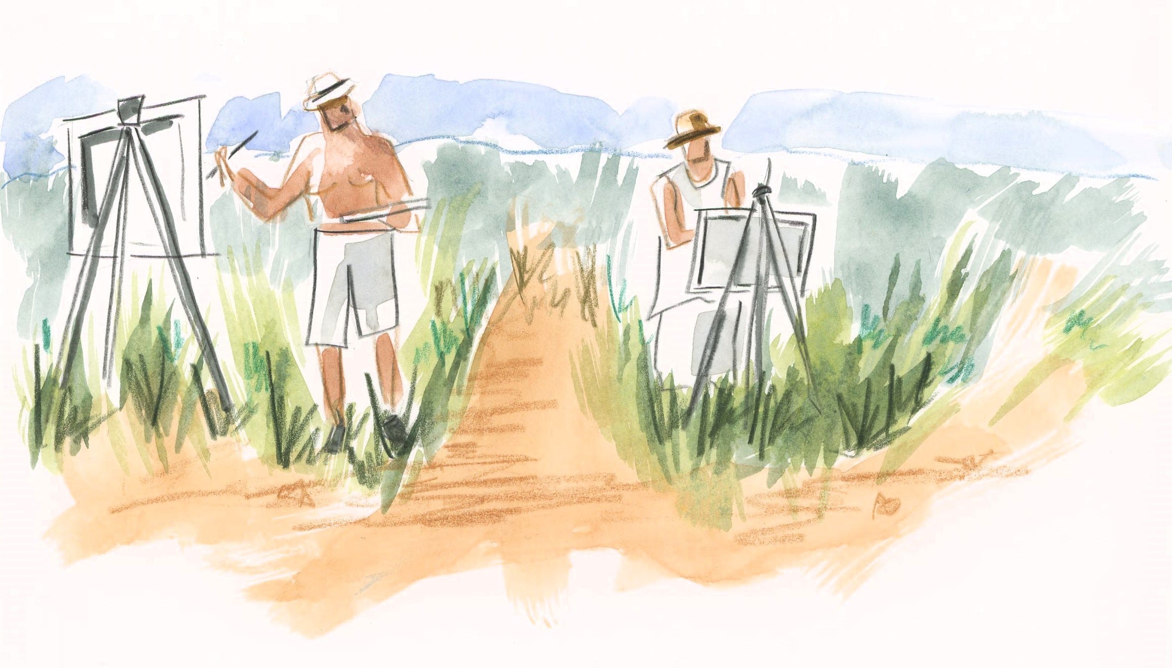
I don’t know, but here they are, painting in the desert, like a couple of bohemian artist hippies. Have they stripped down to their weird old-fashioned underwear? It kind of looks like it.
They stayed at this ranch that CES Wood briefly owned, called the P Ranch. It was owned by a rancher named Peter French, who expanded his land and cattle holdings until he expanded them a bit too far and got shot for it. Wood bought an interest in the property after his death. But then the area was, amazingly, established as a bird refuge in 1908 (this, too, warrants further investigation) and eventually the ranch became government property.
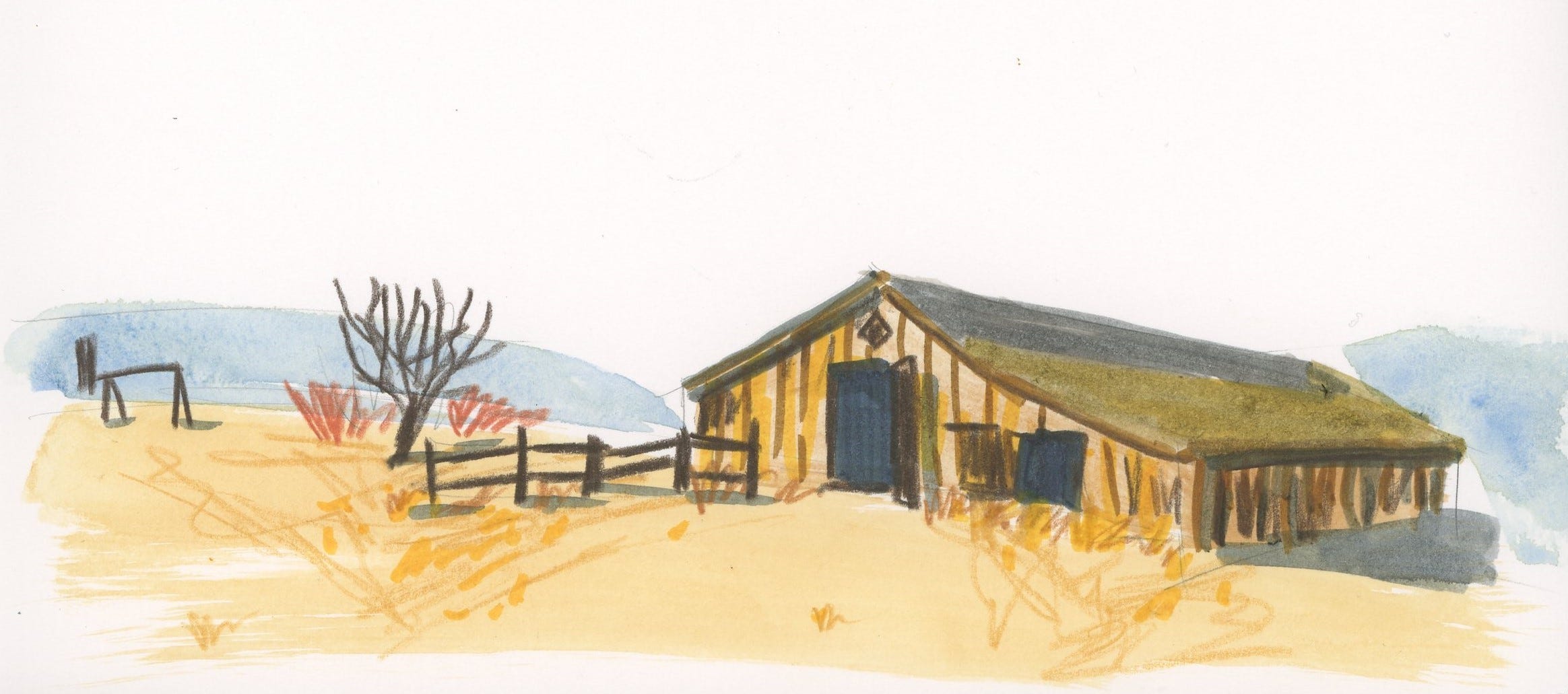
The old buildings are still there, and some of them are used by Fish & Wildlife staff. There’s a beef wheel on the property (far left), a horrible-sounding structure used to hoist up slaughtered cows. It was recently restored. Yes, I feel like a research trip is very much in order—there’s a lot to look into here.
Thank you for reading this far. These are the kinds of things that occupy my mind. It’s nice to have a place to write them down.
Join us for easy, low-stakes watercolor
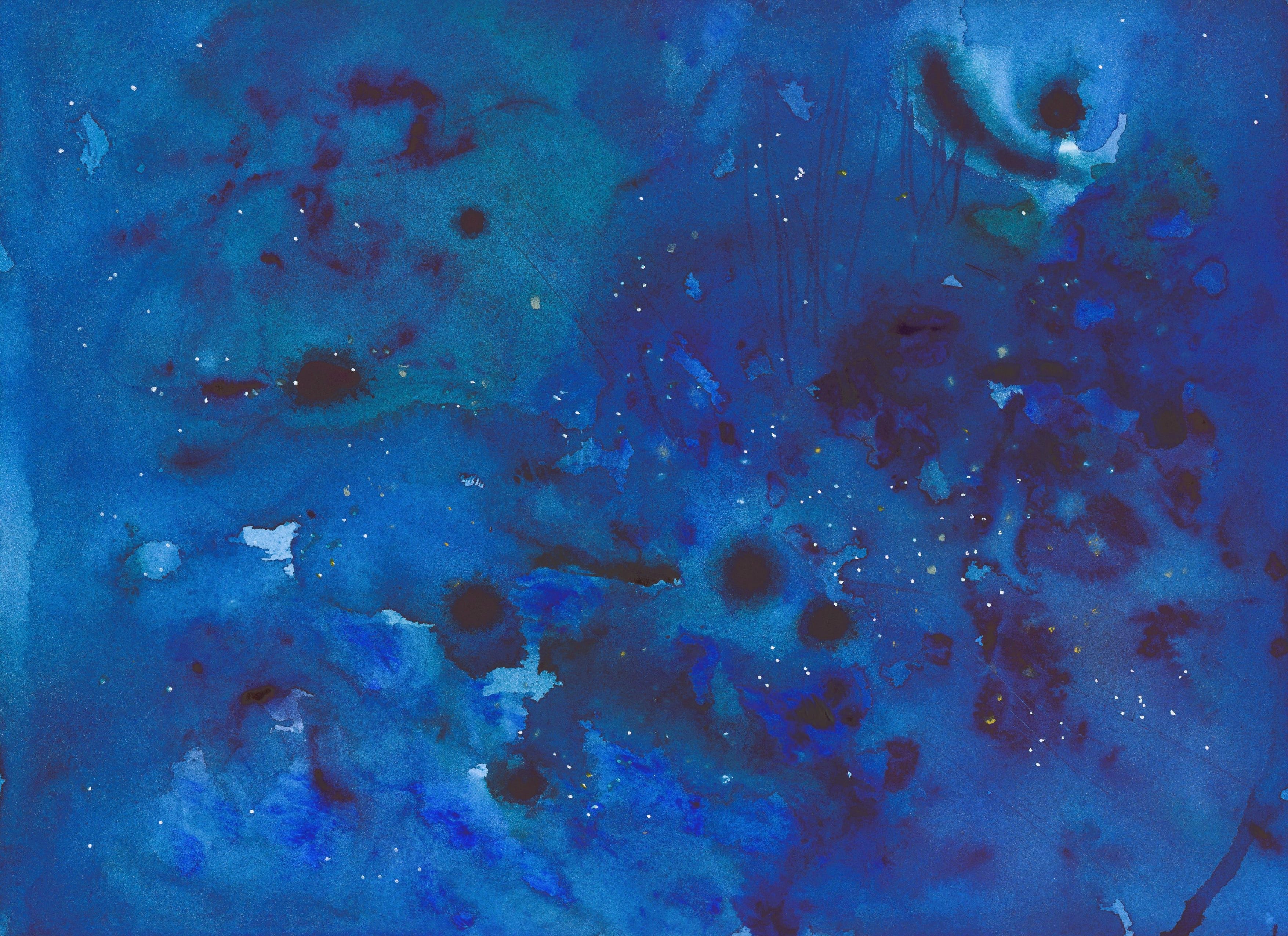
This week, paid subscribers got together for a live Zoom where we made very laid-back, impossible-to-mess-up paintings of the night sky. We used such crazy watercolor effects as salt crystals and rubbing alcohol in a spray bottle. The video’s going out later this afternoon to everyone who couldn’t attend.
Want to join us? Your subscription keeps the lights on around here, and in return, you can dip in and out of a growing archive of art lessons. Many cool things are coming in the new year, including a sort of “fundamentals of drawing” boot camp, and a giveaway where I paint your vacation photo as a lesson, and then mail you the finished painting. Fun, right?
The Bit at the End
Come find me on Instagram, or see paintings for sale- Right here
Order signed copies of some of my books from my husband’s bookstore, or order my books and many books I love at Bookshop.org
Take one of my online writing or art classes here
Post your comments—I love to hear from you! And feel free to share this newsletter. Much appreciated.
This totally looks like a view of Hood from the south. (The large ridge is on the left side instead of in front, like your sketch from the west side.)
Looking at photos of stuff on the south side, it really looks like it might be from what's now known as Trillium Lake, before it was a lake. (1960). Before that, it was part of the Oregon Trail, and was essentially a wide field (Summit Meadow, according to wikipedia, was also a toll station), which would account for the whole bottom part with all the flowers.
If you compare it to this photo, for instance, and replace the artificial lake with a meadow, it's pretty spot-on with regards to the markings of the mountain and where the ridge is. (You'll have to imagine a bit more snow. I think this was probably later in the summer and the painting was likely in spring.). https://images.app.goo.gl/PQ3hhs5zrLNNqPFX7 (goes to a wikipedia photo.)
Hope this gives you more possible leads!
This was a fun read for a Friday morning. It also makes me wonder why I ever left Portland.